Kilitwende Adventures Logo
Northern Circuit

NORTHERN CIRCUIT

Read More Read Less
Serengeti National Park

SERENGETI NATIONAL PARK

  • Location 335km (208 miles) from Arusha, stretching north to Kenya and bordering Lake Victoria to the west.
  • Size 14,763 sq. km (5,700 sq. miles). 14% of the country’s land area.
  • How to get Scheduled and charter flights from Arusha, Lake Manyara, Karatu, Moshi and Mwanza. Access by Driving from Moshi, Arusha, Lake Manyara, Tarangire or Ngorongoro Crater.
  • When to go All year round but if your interest is to follow the wildebeest migration then the best time for this is December-July. And to see predators, June-October.
  • What to do Game drive for wildlife viewing, Hot air balloon safaris, walking safaris, picnicking, Camping, Lodging, Cultural tourism, Visit neighboring Ngorongoro Crater, Olduvai Gorge, Ol Doinyo Lengai volcano and Lake Natron’s flamingos.
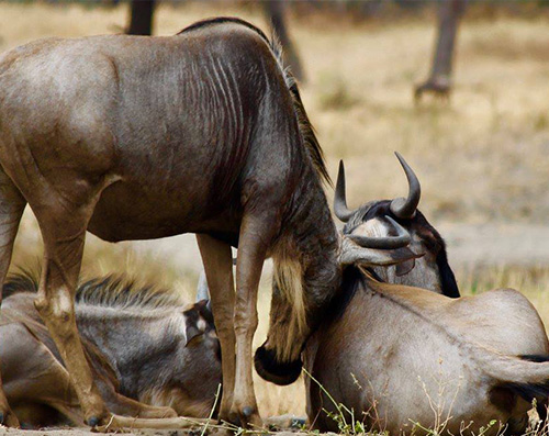
  • What game will you seeThere are so many different species in the Serengeti that this list could go on forever. The Serengeti’s main attraction is the Great Migration, consisting of up to 2 million wildebeest, 200,000 zebras and 350,000 Thompson, impala and grant’s gazelles.The predator viewing opportunities in here are better than anywhere else with 3-4,000 lions, large number of cheetah, hyena, and leopard. Besides that, eland, topi, hartebeest, buffalo, elephant, bat-eared fox, serval, porcupine, hyrax, aardvark, giraffe, jackal, mongoose, monitor lizard, crocodile, and various kinds of primates like baboons, vervet, and colobus monkeys are also seen in here with ease. Moreever, it is home to upwards of 500 bird species and over more than 500 species of birds.

The Endless plains….. The Vastness…. the scent and the wild voices of nature whispering at you. Giving an impression of travelling back in time, the national park of Serengeti is perhaps the most famous wildlife refuge in the world. Its ecosystem is among the oldest on earth. Inherent characteristics like vegetation, climate, and fauna have barely changed at all ove rhte past million years. The Olduvai Gorge whihc is an archaeological site inside the park contains evidence of existence of early men about two million years ago. The pattersn of life, adaptation, migration, and eventually death are as old as the hills and plains themselves. The eco-system extends over a much larger area and includes the Maasai Mara in Kenya and the Ngorongoro Conservation Area, linking over 25,000 km2 of land in which animals can move freely. Much of this is nutritious grassland which acts as a magnet for wildebeest, zebra, impala and Thomson’s gazelle.

Serengeti is the oldest and most popular national park, also a world heritage site and recently proclaimed a 7th world wide wonder, the Serengeti is famed for its annual migration, when some six million hooves pound the open plains, as more than 200,000 zebra and 300,000 Thomson’s gazelle join the wildebeest’s trek for fresh grazing. Even in the absence of the migration, Serengeti is capable of facilitating an admirable game viewing experience in Africa. Herds of buffalo, small and large groups of elephant, giraffe, eland, topi, kongoni, impala, and gazelles help the park in doing so. The Serengeti National Park has four separate sections, each with its own unique features and landscapes: the Southern Plains, Seronera (Central), Western Corridor, and Northern Serengeti.

The southern plain of Serengeti is best described as the “classic Serengeti” and is characterized by short grass plains and flat, open expanses. Seronera which is the famous central territory of Serengeti is located just north of the shrot grass plains. It is famous for open plains, kopjes, and resident and migrating gamees including large number of leopard, cheetah, and lion. To the west of Lake Victoria stretches Western Corridor whihc is home to the Grumeti and Mbalageti rivers which support dense vegetation and evergreen riparian forest. The area falling in between Seronera and border with Kenya is called Northern Serengeti, an area of gently rolling country dotted with occasional hills and kopjes, broken by small rivers. This is where visitors might be at the right place at the right time to view the migration river crossings of the Mara River, made famous by National Geographic documentaries.

Read More Read Less
Ngorongoro Crater

NGORONGORO CRATER

  • By Air One would need to fly to Kilimanjaro International Airport in Moshi first. The town is situated at the foot of Mount Kilimanjaro. From there, you can etiher take a hcarterflight directly into the park or a hire a private taxi. Free shuttle services are also present. The distance from Arusha to Moshi is approximately 55 km.
  • By Road Take note: The road from Arusha to Lodoare Entrance Gate is 160km long. As of recently, the journey in its entirety is on tarmac and takes approximately two hours. Once you divert from the main road and follow the gravelled roads into the park, a 4X4 vehicle will be necessary to enter the Ngorongoro Conservation Area and Serengeti National Park.
  • When to go Since the game stays in the crater all year round, there is really no good or bad time to visit. However, given that the floor of the crater gets busy with safari vehicles, the low season might be the best choice for experiencing this park. As the water level of Lake Magadi (the center of the crater) rises, it subsequently draws more number of flamingos into the area. Whenever you descend down to the crater floor of Ngorongoro, you’ll be guaranteed of excellent game viewing.
  • What to do Activities inside the Ngorongoro Crater itself are limited to game driving only. There are also picnic spots in the park. A full range of activities is however on offer in the wider Ngorongoro Conservation Area, including walking, trekking, excursions to Olduvai Gorge and visiting the Masai and other tribes.
  • What animals to seeThe Ngorongoro is the best place in Tanzania to see the big five. The prize spot in this territory includes a healthy population of black rhinoceros and some of the largest elephants remaining in Africa today. The crater is also home to a diverse set of lions, leopad, and hyenas along with herds of wildebeest, hartesebeest, buffalo, and zebra. Other game in the Ngorongoro includes serval cat, cheetah, jackal, Grant’s and Thompson’s gazelle, flamingo and bat eared foxes along with approximately 400 species of bird.

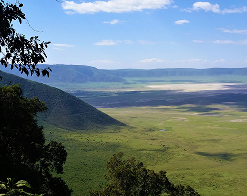
The territory of Ngorongoro Conservation Area includes the area from Crater Highlands to teh Serengeti and the northern shore of Lake Eyasi. The volcanic movement which resulted in the formation of the Great Rift Valley are also responsible for formation of Ngorongoro Crater. It is theorized to have been as high as Mount Kilimanjaro at one point in time. The eruption occurred approximately 3 million years ago and covered whole of Serengeti in ash, leaving a large crater in the ceneter. This is what we today know as Ngorongoro Crater which is the largest intact caldera in the world with a diameter of around 18 km and surface area of about 260 sq km. The steep crater ridge is more than 600m at its highest point.

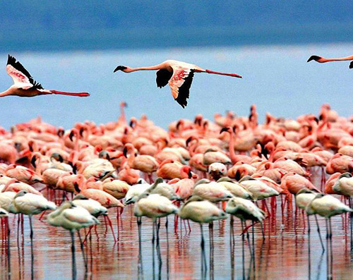
The crater floor is an earthly paradise and, with about 30,000 animals, one of the most populous wildlife areas in the world. Because the area is enclosed and the flat crater floor is mainly open grassland, it is easy to manage, with the result that it is a stronghold of endangered species, including the black rhino and the cheetah. There are no giraffes, topi or impala in the crater. These animals find the rocky areas too difficult to use and there is insufficient grass for large herds of antelope. The main prey animals are wildebeest, zebra and buffalo and the main predators are the lions and spotted hyenas. In the open savannah a hunt can be followed quite easily, and is especially interesting as it seems that in Ngorongoro, contrary to what one might expect, the hyenas are the aggressive hunters and the lions are the carrion eaters. In the southwest of the conservation area lies Lake Magadi which is a large shallow soda lake inhabited by countless pink flamingos along with water fowl and hippopotamus.

The magnificent Ngorongoro Crater is only a small fragment of the bigger Ngorongoro Conservation Area. Other attractions inside the park are two lesser-known craters known as Olmoti and Empakaai. An added advantage of visiting these craters is that you’ll be able to descend all the way to the foot of Olmoti or the rim of Empakaai either by walking or driving. At its western rim, Olmoti rises about 3073 m and is reachable by walking through bush and grassy tussocks layered with flowers. An additional highlight of the area is the Munge Falls, which flow through a cleft on the Crater’s southern side. The stream cascades down steep cliffs, hundreds of metres into a ravine.

From the edge of the crater the road twists downwards towards the Serengeti through rolling grass plains and acacia forests. About 30 kilometres from the crater, there is a narrow road to the Olduvai Gorge. At the site of the gorge, which is approximately 90 metres deep, there was once a lake. Over the years, the lake was covered with thick layers of volcanic ash, which preserved the remains of early humanity. To be so close to where mankind may have begun is an inspiring experience, especially when you see the famous Laetoli footprints, made by early humans some 3.6 million years ago.

Read More Read Less
Tarangire National Park

TARANGIRE NATIONAL PARK

  • Location 118 km (75 miles) southwest of Arusha.
  • Size 2850 sq. km (1,096 sq. miles).
  • How to get Easy drive from Arusha or Lake Manyara following a surfaced road to within 7km (four miles) of the main entrance gate; can continue on to Ngorongoro Crater and the Serengeti. Charter flights from Arusha and the Serengeti.
  • When to go Open year round, but dry season between the months of June and September is recommended.
  • What to do Guided walking safaris.
  • Guided walking safaris, day trips to villages of Maasai and Barabaig tribe, visiting sites of ancient rock paintings in the vicinity of Kolo which falls on the Dodoma Road.

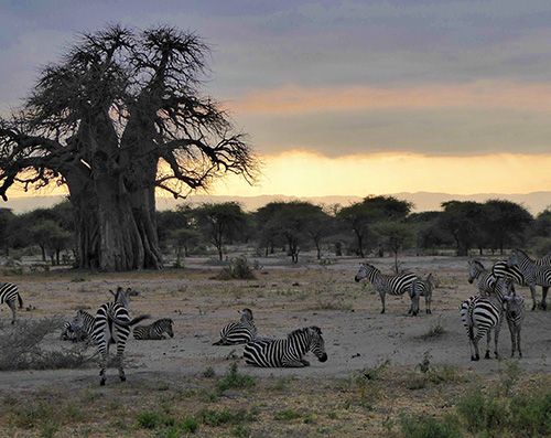
Tarangire National Park stretches over an area of approximately 2,600 sq miles or 6,700 sq kms. It lies to the south of a large open grass plain, about 70 miles from Arusha. Highly praised for its concentration of birdlife, visitors are also always entertained by the migrating elephants, buffalos, giraffes, zebras, elands, warthogs, greater kudus, impalas etc. The baobab trees, Tarangire River, and the volcanic mountain ranges add on to the beauty of this unique national park of Tanzania.

Read More Read Less
Lake Manyara National Park

LAKE MANYARA NATIONAL PARK

  • Location In northern Tanzania. The entrance gate lies 1.5 hours (126km/80 miles) west of Arusha along a newly surfaced road, close to the ethnically diverse market town of Mto wa Mbu.
  • Size 330 sq. km (127 sq. miles), of which up to 200 sq. km (77 sq. miles) is lake when water levels are high.
  • How to get By road, charter or scheduled flight from Arusha, en route to Serengeti and Ngorongoro Crater.
  • When to go Dry season (July-October) for large mammals;
  • Wet season (November-June) for bird watching, the waterfalls and canoeing.
  • What to do Game drives, night game drives, canoeing when the water levels is sufficiently high.
  • Cultural tours, picnicking, bush lunch/dinner, mountain bike tours, abseiling and forest walks on the escarpment outside the park.

Lake Manyara National Park is among the finest and most intresting Tanzanian protected areas with a rich proportion of wild animals even when the park covers roughly 330 sq km, two-third of which si covered with water. Following suit with other lakes of the Rift Valley, Lake Manyara is a shallow soda lake fed primarily by the groundwater. Depending upon the season and rainfall, the size varies. The thin strip of land between the lake and the surrounding hills is the only place where game drives in the park are conducted. The park and the lake trace the origin of their name to the Manyara-scrub which is used by the Maasai to protect their fields. The first section of the park comprises of dense forest with high trees which includes the type of mahagony, crotonic, palm, and fig. The undergrowth is composed of wild flowers which accommodate countless butterflies. But this park is not recommended for witness the game animals, because it is very difficult to look through the dense forest.

When you drive further into teh park, you’ll be able to see groups of Anubis baboons and Skyes monkeys cheerfully playing along teh road side. Bushbucks will appear out of the bushes and it is very possible you may bump into an elephant on the road. Elephants often use the road so that they do not have to go through the thick bush. Also remember to look up once in a while. Just like in Tarangire, the lions are sometimes in the trees and also a lot of leopards live in this area (though you have to be lucky to spot them). If the big cats cannot be found in the trees, there are a lot of birds to spot in the trees.

The further you go in the park, the drier it gets. Gradually the forest opens up and the vegetation changes, with a lot of baobab trees. The change in vegetation also results in other types of game. In this part of the park buffalo, wildebeest, zebra and giraffe have their home. In the air, eagles are looking for a prey. On the south side of the park there are a number of steamy hot springs whose chemicals have given the surrounding land the colours of the.

Read More Read Less
Kilimanjaro National Park

KILIMANJARO NATIONAL PARK

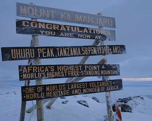
  • Location Mount Kilimanjaro is located in Tanzania, a country in East Africa. The mountain Size is 1668 sq. km /641 sq. miles and it’s one of the seven summits (the highest peaks on each of the seven continents) Mt Kilimanjaro rises 5,895 meters or 19,340 feet above sea level. The dormant volcano last erupted some 300-300 years ago, and could erupt again. Kilimanjaro is composed of three cones, namely Mawenzi, Kibo, and Shira, the highest of which is Kibo. The highest point in the cone is called Uhuru which translates to freedom in Swahili.
  • How to get Mount Kilimanjaro is a major tourist attraction for experienced and beginning climbers. To get to the mountain, the most convenient way is to fly into Tanzania (Kilimanjaro International Airport), and then travel to Arusha or Moshi, Kilimanjaro’s gateway towns, by vehicle. Both cities are approximately 40 minutes away from the airport and taxi services are readily available. Tanzania Expeditions offers expert travel planning and guides for getting here!
  • When to go The best times for climbing Kilimanjaro are the driest months of the year, especially Jan, Feb and Aug, Sep. But any month between January to mid-March and June to October is recommended. Safety, being able to enjoy the hike, and have an a fulfilling experience are the main parameters which determine satisfaction level. We don’t recommend trekking when it’s a rainy season as the effects of rain, mud, snow, ice and cold can be very strenuous on the body. Correspondingly, your chances of a successful summit also increase significantly with nice weather. Of course, the mountain gets more foot traffic during these periods as well.
  • how many days and which route to take while climbing Kilimanjaro There are six established routes to use while climbing Kilimanjaro. They vary in length and difficulty. All except one require you to camp. If you climb Kilimanjaro on the Marangu route your accommodation is in huts and camping is not allowed.
  • Five days is the absolute minimum duration for a Kilimanjaro climb, six is better. If climbing using the Machame route six days is the minimum, seven days is recommended.
  • Taking an extra day for acclimatization will greatly improve your chances to reach the summit. There are longer treks available for those who can afford them. Take a look at our Kilimanjaro climbing Itineraries and packages.
  • How do i prepare for climbing KilimanjaroMt Kilimanjaro is the highest mountain in Africa and does not require any technical climbing! All you need is walk slow but steady. For the summit to be reached, your body must sufficiently acclimatize itself. It is important to be physically, emotional and spiritual prepared for the Kilimanjaro Expedition. Another important part of the preparation is having the proper equipment before you depart to Tanzania.
  • Physical preparationIt is very important that your body is properly prepared for the physical challenge of the Kilimanjaro. The better prepared you are, the better you plan to conquer the highest point of Africa. Good preparation will make a significant contribution to your own confidence and your mental strength.
  • Mental preparationMt Kilimanjaro is an amazing experience and anyone is able to reach its summit (Uluru peak). Think about this when you prepare yourself for the expedition. You will not be alone as KiliTwende Adventures Kilimanjaro Dream Team will make you feel welcome and will be there with you all the way. Always think positively and you WILL enjoy the climb! Remember it is a journey and not a destination.
  • How will i get fitThe type of condition is more important than the degree of fitness. Kilimanjaro is a walk and the interesting part of it is you take your time, no rush, so the best preparation you can have is to walk, preferably under simulated conditions. Even after your regular jogging/running exercises, your leg muscles aren’t fully prepared for the seven days of quiet, yet heavy, continuous walking. For the heavy walking tour, you should ignore the elevators and shortcuts and walk for long distances instead.
  • Go walk, for example, in addition to regular fitness to let your muscles develop more. If possible, opt for walking in varying altitude so that you can practice walking up and down at various incline levels..
  • Once you’re able to walk 80 kilometers in one week, you have done the Kilimanjaro Machame Route. Train your body for extra resistance for your muscles, because on the mountain the inclination varies.
  • In a period of eight weeks, using the gym and the many hikes, you can become fit enough for Mt Kilimanjaro climb.
  • Medical check-upBefore starting a physical training program, it’s always wise to get the approval of a doctor. Also knowing your health conditions from the doctor is every essential key as you will be hiking at a high altitude and its very risky if by a mistake you didn’t consult a doctor and found out you have heart or lung problems and you need evacuation from Kilimanjaro.
  • What to know about Altitude Sickness while climbing KilimanjaroThe definition of altitude Sickness (Acute mountain sickness) Is an illness that ranges from a mild headache and weariness to a life-threatening build-up of fluid in the lungs or brain at high altitudes. Acute altitude sickness is the mildest and most common form. Because more people are traveling to areas of high elevation like climbing Kilimanjaro.
  • High Altitude: 1500 – 3500 m (5000 – 11500 ft.)
  • Very High Altitude: 3500 – 5500 m (11500 – 18000 ft.)
  • Extreme Altitude: above 5500 m (18000 ft.)
  • What to do to Acclimatize and prevent altitude sickness while climbing Kilimanjaro Acclimatization is the process in which an individual organism adjusts to a gradual change in its environment. So while you’re climbing Kilimanjaro your body undergoes a process of trying to adapt the altitude transformation.
  • So from a philosophical point of view, when you ascend higher into the atmosphere, there is decreased atmospheric pressure pushing the air molecules down together. This results in oxygen molecules being low in concentration and far between.

Thinking about Climbing Mount Kilimanjaro?

And Wondering how to do it and where to begin……?

Let’s say you know someone or heard a friend who made it to to the summit of Mount Kilimanjaro and your also desperate and want to be next. First thing is to Relax, be calm! Below we have composed a simplified climbing Kilimanjaro guide which has all the information and instructions to prepare you from beginning to end. You don’t want to be those people who rush into things then end up failing and disappointed because of one thing…..they did not do any research or prepare. It costs allot and it takes time. You also want to enjoy the trek, so planning ahead of time is the key.

Let’s begin…